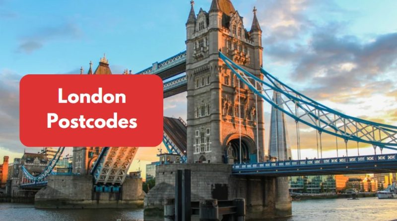
Have you ever wondered how London’s postcode system works and why it’s essential? Postcodes in London are more than just addresses; they define areas, influence property prices, and play a crucial role in logistics, business operations, and navigation.
Whether you’re moving to London, buying a property, or simply curious about postcodes, understanding the system can be incredibly useful.
London postcodes are divided into different districts, each representing specific areas, making mail delivery and location identification easier.
This guide will help you find your postcode, explore the list of postcodes in London, and understand how they impact various aspects of daily life.
Keep reading to discover everything you need to know about London postcodes and how they are structured!
What is the London Postcode System?
London’s postcode system was introduced in 1857 by the Royal Mail to streamline mail delivery and improve efficiency.
The city was initially divided into ten postal districts, each represented by a letter-based code.
Over time, these districts were further divided into sub-districts, leading to the system we use today.
Each London postcode consists of two main parts:
- Outward Code: Identifies the postal area (e.g., NW1, SW3).
- Inward Code: Pinpoints specific locations within the district (e.g., 1AA, 3DX).
For example, in SW1A 1AA (the postcode for Buckingham Palace):
- SW refers to South West London.
- 1A narrows it down to a specific district.
- 1AA pinpoints the exact location.
The London postal districts don’t always align perfectly with borough boundaries, which can sometimes cause confusion.
However, postcodes remain essential for navigation, property searches, and official documentation.
How Are London Postal Districts Divided?
London’s postal districts are structured to streamline mail delivery, navigation, and administrative tasks.
These districts are identified by unique letter and number combinations that help define different areas.
The system was originally designed for postal efficiency but now influences property prices, business operations, and even insurance rates.
Structure of London’s Postal Districts
- Outward and Inward Codes: The first part of a postcode (outward code) indicates the area, while the second part (inward code) pinpoints a specific location.
- Historical Boundaries: Postcode districts do not always align with borough boundaries; instead, they reflect historical divisions.
- Expansion Beyond London: Some postcodes extend into bordering counties like Essex, Hertfordshire, and Surrey, covering towns like Romford (RM) and Croydon (CR).
Main Postal Districts in London
- EC (Eastern Central): Covers the City of London, including Bank and Moorgate.
- WC (Western Central): Includes Bloomsbury and Covent Garden.
- N (North London): Encompasses Camden and Islington.
- E (East London): Features Stratford and Canary Wharf.
- W (West London): Includes Westminster and Notting Hill.
- SE (South East London): Covers Greenwich and Lewisham.
- SW (South West London): Features Chelsea and Wimbledon.
These divisions make it easier to navigate, conduct business, and assess property values across London.
What Are the List of Postcodes in London?
London is a city made up of numerous districts, each with its own unique postcode area. These postcode areas help in organizing and identifying specific regions of the city.
Below is a breakdown of the key postcode areas in London, with the exact district names within each area:
1. Eastern Postcode Area (E)
The Eastern postcode area covers a large part of East London, including both residential and commercial districts.
It is home to some of the most diverse and historically significant areas in the city.
| Postcode | Districts |
| E1 | Whitechapel, Spitalfields |
| E2 | Bethnal Green |
| E3 | Bow |
| E4 | Chingford |
| E5 | Clapton |
| E6 | East Ham |
| E7 | Forest Gate |
| E8 | Hackney |
| E9 | Homerton |
| E10 | Leyton |
| E11 | Leytonstone |
| E12 | Manor Park |
| E13 | Plaistow |
| E14 | Poplar |
| E15 | Stratford |
| E16 | Victoria Docks, North Woolwich |
| E17 | Walthamstow |
| E18 | Woodford, South Woodford |
| E20 | Olympic Park |
2. Eastern Central Postcode Area (EC)
The EC postcode area represents the heart of London’s business and legal districts. This area includes a mix of both historical landmarks and modern skyscrapers.
| Postcode | Districts |
| EC1 | Clerkenwell, Farringdon |
| EC2 | Bishopsgate |
| EC3 | Fenchurch Street |
| EC4 | Fleet Street |
3. Northern Postcode Area (N)
Northern London is known for its beautiful suburban districts and green spaces.
The N postcode area includes a blend of residential and commercial zones spread across the northern part of the city.
| Postcode | Districts |
| N1 | Islington, Angel |
| N2 | East Finchley |
| N3 | Finchley |
| N4 | Finsbury Park |
| N5 | Highbury |
| N6 | Highgate |
| N7 | Holloway |
| N8 | Hornsey |
| N9 | Lower Edmonton |
| N10 | Muswell Hill |
| N11 | New Southgate |
| N12 | North Finchley |
| N13 | Palmers Green |
| N14 | Southgate |
| N15 | South Tottenham |
| N16 | Stoke Newington |
| N17 | Tottenham |
| N18 | Upper Edmonton |
| N19 | Upper Holloway |
| N20 | Whetstone |
| N21 | Winchmore Hill |
| N22 | Wood Green |
4. South Eastern Postcode Area (SE)
The SE postcode area is located in the southeastern part of London and covers a wide range of vibrant neighborhoods. This area is known for its cultural diversity and green spaces.
| Postcode | Districts |
| SE1 | Southwark, Borough |
| SE2 | Abbey Wood |
| SE3 | Blackheath |
| SE4 | Brockley |
| SE5 | Camberwell |
| SE6 | Catford |
| SE7 | Charlton |
| SE8 | Deptford |
| SE9 | Eltham |
| SE10 | Greenwich |
| SE11 | Kennington |
| SE12 | Lee |
| SE13 | Lewisham |
| SE14 | New Cross |
| SE15 | Peckham |
| SE16 | Rotherhithe |
| SE17 | Walworth |
| SE18 | Woolwich |
| SE19 | Norwood |
| SE20 | Anerley |
| SE21 | Dulwich |
| SE22 | East Dulwich |
| SE23 | Forest Hill |
| SE24 | Herne Hill |
| SE25 | South Norwood |
| SE26 | Sydenham |
| SE27 | West Norwood |
| SE28 | Thamesmead |
These postcode areas form a key part of London’s urban structure, helping residents and businesses identify specific locations.
Each district is rich in history and offers its own unique characteristics, making London an exciting city to explore.
How Can You Find Your Postcode in London?

Finding your postcode in London is simple with various postcode search tools, maps, and online directories.
Whether you’re a resident, business owner, or new to the city, knowing your postcode is essential for deliveries, navigation, and official documentation.
Ways to Find Your Postcode
- Online Postcode Checkers: Websites like Doogal.co.uk and Postcodearea.co.uk allow users to enter an address and find the corresponding postcode instantly.
- Royal Mail Postcode Finder: The official tool from Royal Mail offers an accurate postcode search for any address across the UK.
- Google Maps: Entering an address in Google Maps provides postcode details along with street information.
If you’re unsure about your postcode, using these tools ensures accurate address formatting for deliveries, legal purposes, and location identification.
Regularly checking postcode maps can also help in understanding any recent changes to postcode districts in London.
What is the Difference Between London Postcodes and Greater London Postcodes?
London postcodes and Greater London postcodes serve different purposes, often leading to confusion.
While London postcodes are primarily designed for mail delivery, Greater London postcodes extend beyond the city’s administrative boundaries into outer boroughs and surrounding counties.
Key Differences
- London postcodes focus on postal districts rather than administrative regions. They are used to efficiently manage mail delivery within Inner and Central London.
- Greater London postcodes extend into areas outside of Central London, covering parts of Essex, Kent, and Surrey.
- Some boroughs, such as Croydon (CR0) and Romford (RM1), have their own postcode systems, separate from the traditional London postcode structure.
This distinction is crucial for businesses, property buyers, and residents. Some areas may have a London postal address but are administratively outside of Greater London, which can affect council tax, transport zones, and service availability.
How Do London Postcodes Affect Property Prices and Living Costs?

Postcodes in London play a significant role in property values and living costs. The desirability of an area, its amenities, and transport links can significantly impact housing prices.
Generally, properties in prime postcodes command higher prices, while areas on the outskirts of Greater London offer more affordable housing.
Impact on Property Prices
- Luxury postcodes like SW1 (Belgravia) and W1 (Mayfair) have multi-million-pound properties due to their central location and premium facilities.
- More affordable postcodes, such as E16 (Canning Town) and SE28 (Thamesmead), provide budget-friendly housing options with growing demand.
Living Costs
- Expensive locations (e.g., Kensington, Chelsea) have high rents, council tax, and cost of living.
- More affordable boroughs (e.g., Barking, Croydon) offer lower rental prices and cheaper amenities.
Understanding postcode-based property trends can help buyers, renters, and investors make informed decisions about where to live or invest in London.
What Are the Most Expensive and Cheapest Postcode Areas in London?
London’s property market is heavily influenced by postcodes, with some areas commanding premium prices while others remain budget-friendly.
Most Expensive Postcodes
- SW1X – Knightsbridge (£3M+ average property price): Home to luxury apartments and high-end stores.
- W8 – Kensington (£2M+): A prime location with historic buildings and elite schools.
- NW3 – Hampstead (£1.5M+): Known for its charming streets and celebrity residents.
Cheapest Postcodes
- SE28 – Thamesmead (£350K average price): Offers affordable homes with ongoing regeneration projects.
- E6 – East Ham (£400K): A budget-friendly area with good transport links.
- RM13 – Rainham (£450K): Provides suburban housing at lower prices than inner London.
Postcodes significantly impact property values, influencing investment decisions and desirability for buyers and renters.
Are There Any Upcoming Changes to the London Postcode System?
London’s postcode system continues to evolve due to urban development, population growth, and infrastructure expansion.
The Royal Mail periodically reviews postcode boundaries to enhance efficiency in mail delivery and address allocation.
Potential Changes
- Some postcode sectors may be split or restructured to accommodate new housing developments and businesses.
- Expanding areas such as Stratford, Canary Wharf, and Croydon may see postcode updates to reflect new residential and commercial zones.
- New postcode sectors may be introduced in emerging regeneration areas, particularly in East and South London.
These changes can impact property values, council tax, and public services, making it essential for residents and businesses to stay informed about postcode revisions in their area.
Conclusion
Understanding London postcodes is essential for navigation, property investment, and business operations. Whether you’re looking for a postcode finder UK, exploring postcode areas in London, or researching postcode boundaries, this guide provides a complete overview.
Postcodes not only help with mail delivery but also play a crucial role in determining property prices, council tax rates, and transport accessibility.
Some areas with prestigious London postal codes may fall outside of the city’s administrative boundaries, affecting local services and taxes.
If you are moving, buying a property, or simply need to find an address, using tools like Royal Mail’s Postcode Finder, Google Maps, or online postcode databases can help. Always check official postcode maps to ensure accurate details for your address.
Whether you live in Central, North, East, West, or South London, knowing your postcode can be incredibly beneficial.
FAQs About London Postcodes UK
How do I check if a postcode is in London?
You can check a postcode using online tools like Doogal.co.uk or the Royal Mail postcode finder. Simply enter the postcode to confirm its location.
What is the smallest postcode area in London?
The WC2 postcode in Central London is one of the smallest, covering a limited area including Covent Garden and parts of the Strand.
Why do some London postcodes have letters like EC, WC, and SW?
These letters represent geographic regions in London, such as EC (Eastern Central), WC (Western Central), and SW (South West London).
Can two places have the same postcode in London?
Yes, postcodes often cover multiple addresses or buildings, especially in high-density areas like apartment complexes and commercial zones.
What’s the difference between a postcode and a postal town in the UK?
A postcode pinpoints specific locations, while a postal town is a broader area used for addressing mail, such as London or Birmingham.
How does a postcode affect council tax in London?
Council tax varies by London borough postcodes, with more affluent areas generally having higher council tax bands than less expensive regions.
Are London postcodes used for emergency services and GPS navigation?
Yes, emergency services and GPS systems rely on London postcodes to quickly locate addresses, ensuring faster response times in urgent situations.